Tuesday, December 17, 2013
ESRIEdTeam Youtube Channel
Looking for videos on how to explain GIS? Use GIS? Tips and tools, educational presentations, and more can be found on the ESRI Education Team Youtube Channel!
Monday, December 16, 2013
Virtual Field Trips
Lesson plan on creating a virtual field trip in Google Earth from Dr. Paddington Hodza:
Terrain Navigation in Google Earth
There is a wealth of information
to be found in Google Earth mainly from embedded satellite and aerial imagery,
street data and 3D terrain models. Users
can discover, for example, how people around the world are modifying natural
environments into settlements, agricultural fields and mining sites. In
addition, users can bring their own data (e.g. demographic, environmental,
etc.) into Google Earth. They can explore, analyze and interpret this data and
solve geographic problems.
MyWorld GIS
My World GIS™ is a Geographic Information System (GIS) designed specifically for use in educational settings. My World allows learners to explore and analyze geographic data about our world.
My World's intended audience is middle school through college geosciences and geography courses involving investigations of geographic data.
My World is designed to meet the needs of students and teachers while keeping the constraints of educational settings in mind. It combines the power of a full-featured GIS environment with the support and structure required by novice users in an educational environment.
http://www.myworldgis.org
Layers of Our World
In this salute to GIS Day ESRI uses ArcGlobe 3D Analyst and ArcMap to provide multiple perspectives of Earth. Special thanks to Digital Globe and EarthSat for their images used in this video.
http://gisandscience.com/2009/10/08/video-layers-of-our-world/
http://gisandscience.com/2009/10/08/video-layers-of-our-world/
Maps and the Geospatial Revolution
The past decade has seen an explosion of new mechanisms for understanding and using location information in widely-accessible technologies. This Geospatial Revolution has resulted in the development of consumer GPS tools, interactive web maps, and location-aware mobile devices. These radical advances are making it possible for people from all walks of life to use, collect, and understand spatial information like never before.
This course brings together core concepts in cartography, geographic information systems, and spatial thinking with real-world examples to provide the fundamentals necessary to engage with Geography beyond the surface-level. We will explore what makes spatial information special, how spatial data is created, how spatial analysis is conducted, and how to design maps so that they’re effective at telling the stories we wish to share. To gain experience using this knowledge, we will work with the latest mapping and analysis software to explore geographic problems.
https://www.coursera.org/course/maps
Larimer County GIS
Online portal for Larimer county, CO. To view layers associated with this county, visit the site directly:
ArcGIS Online
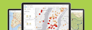
Did you know that Colorado has a statewide license for educational use of ArcGIS online? Contact COGA directly for more details!
Quickly create interactive maps and apps and share them with the rest of your organization. Be productive right away with ready-to-use content, apps, and templates available for browsers, smartphones, and tablets.
GRASS GIS
http://grass.osgeo.org
GIS Day
GIS Day provides an international forum for users of geographic information systems (GIS) technology to demonstrate real-world applications that are making a difference in our society.
The first formal GIS Day took place in 1999. Esri president and co-founder Jack Dangermond credits Ralph Nader with being the person who inspired the creation of GIS Day. He considered GIS Day a good initiative for people to learn about geography and the uses of GIS. He wanted GIS Day to be a grassroots effort and open to everyone to participate.
GIS Day is One Fun Day to
- Celebrate GIS with everyone
- Discover and explore the benefits of GIS
- Showcase the uses of GIS
- Build and nurture your GIS community
GIS Careers
Consider a Career in GIS
GIS is a key emerging and evolving industry throughout the world.
GIS careers exist in every imaginable discipline, from environmental science to commercial businesses and much more. This wide range of opportunities available lets you combine your passions or interests with GIS for a satisfying and successful career.
GIS And Remote Sensing of Darfur

http://www.yale.edu/gsp/gis-files/darfur/index.html
GeoMedicine

How does your environment impact your personal health? Geomedicine produces a new type of medical intelligence that leverages national spatial data infrastructures to benefit personal human health and improve the quality of the care medical professionals deliver.
What is GIS?
Looking for a way to explain what GIS is? This great short flash video from ESRI can help to explain it!
http://www.esri.com/apps/esriclips/flash.cfm?path=71
http://www.esri.com/apps/esriclips/flash.cfm?path=71
ArcLessons
ArcLessons is a resource for you to share resources for using GIS in educational settings. You can browse a list of resources by category or use the search tools to find resources in your area of interest. You can contribute your resources to ArcLessons for other educators to use.
The resources on ArcLessons have been created by educators for use in a variety of educational settings.
Friday, December 13, 2013
Lufthansa Virtual Pilot
Can you land the Lufthansa plane in the correct city? Once the jet takes off, the name of a European city will appear on the screen. You'll start with 8 seconds to correctly identify the location of that city by clicking on the map.
Funbrain

- FUNBRAIN will show you maps.
- For each screen, identify the correct country (or state). Check the correct box or type in the name (spelling counts).
- If you select level 5, you will also have to type in the name of the country's or state's capital.
Visited Countries Map
This is a free tool for making your visited countries map. Check the countries you visited, choose colors, size of a map and press "Make map" button. You can also make your visited states map.
http://www.ammap.com/visited_countries/
http://www.ammap.com/visited_countries/
Walk Score
Walk Score rates over 10,000 neighborhoods in almost 3,000 cities across the United States, Canada, and Australia so you can find a walkable home or apartment.
We believe that walkable neighborhoods with access to public transit, better commutes, and proximity to the people and places you love are the key to a happier, healthier and more sustainable lifestyle.
Tourality

Google Lit Trips

GeoSense

http://www.geosense.net
Geo-Globe
Explore the world with Geo - Globe's selection of interactive games, and find out about strange and familiar features of the planet! Ever wondered which continent has the most countries? Do you know how deep the ocean gets? How plants survive in the tundra? Which waterfall is the highest in the world?
http://library.thinkquest.org/10157/
http://library.thinkquest.org/10157/
GeoCaching
http://www.geocaching.com
Free Online Geography Drills

http://www.clickandlearn.cc/FreeUSA/Free.htm
Geo Quiz from PRI
The Geo Quiz from PRI's The World challenges your knowledge of people and places, geography and culture. Created by journalists in the newsroom, each Geo Quiz question comes with its own answer, a fascinating report or interview that reveals a mystery location.
http://pri.org/collections/geo-quiz
http://pri.org/collections/geo-quiz
Online Personal Finance Games

Colonial Williamsburg Electronic Field Trips
Teach American history with the new Electronic Field Trip season. These live, interactive lessons explore the Bill of Rights, the three branches of government, 18th-century trades and the Continental Army, the complicated relationships between slaves and their masters, Civil War ironclads, and the War of 1812.
http://www.history.org/history/teaching/eft/
http://www.history.org/history/teaching/eft/
Cloud of Atlases

http://www.themorningnews.org/article/cloud-of-atlases
Global Detention Project
http://www.globaldetentionproject.org/home.html
Geographic Inquiry into Global Issues
Geographic Inquiry into Global Issues was developed at the Center for Geography Education at the University of Colorado, Boulder. The National Science Foundation provided the funds, with A. David Hill as the Project Director. The modules were drafted by teachers and scholars and then tested in classrooms throughout the United States. In the original publication, teachers received a classroom set of Student Data Books and one binder that contained the Teacher's Guide and supporting materials. Professor Hill recently secured permission to distribute the modules free of charge to anyone who can use them for educational purposes.
http://www.unco.edu/geography/GIGI/GIGI%20HOME.htm
http://www.unco.edu/geography/GIGI/GIGI%20HOME.htm
Introduction to Globalization
From Dr. Emily Skop of the University of Colorado Colorado Springs, this powerpoint introduces the concepts of globalization:
Introduction to Globalization
Introduction to Globalization
Teaching with the News

http://www.choices.edu/resources/current.php
AAG Center for Global Geography Education
The AAG Center for Global Geography Education (CGGE) is an innovative, online collection of geography course modules for undergraduate education. CGGE currently offers six modules: Global Economy, Migration, Population and Natural Resources, Global Climate Change, Water Resources, and National Identity.
Each CGGE module features a set of regional case studies, student activities, and collaborative projects that use the Moodle e-learning platform to connect geography classes internationally. CGGE also sponsors workshops to support the development of new case studies and collaborative projects.
Water First
WATER FIRST Reaching the Millennium Development Goals (MDGs), is a character-driven film directed by Amy Hart that conveys the importance of clean water and sanitation in addressing all major global issues and achieving the MDGs set forth by the UN to reduce poverty in developing nations.
http://www.hartproductions.org/data/
http://www.hartproductions.org/data/
Colorado Foundation for Water Education
The mission of the Colorado Foundation for Water Education is to promote better understanding of Colorado's water resources and issues by providing balanced and accurate information and education. We accomplish our mission through the production of high-quality educational tools and experiences-- which we've been doing since 2002.
Human-Environment Interaction, Four Corners Summer Institute 2011
In 2011, COGA hosted the Four Corners Summer Institute, a teacher professional development workshop that focused on the geography of human-environment interactions. You can find the resources from this workshop here:
Human Environment Interaction (Four Corners Summer Institute 2011)
- Asking Geographic Questions
- Community Mapping: Putting Pieces Together
- Into the Field
- Place- and Community-Based Education in Schools
- Place-Based Education
- Reading Landscapes
- The Six Elements and Eighteen Standards of Geography
- Using an Urban "Attractiveness Index" as a Method in Teaching College-Level Field Geography
- Integrating Literture and the Social Studies with Google Lit Trips
- Lessons from the Bioregion
- Sense of Place and Place-Based Introductory Geocience Teaching for American Indian and Alaska Native Undergraduates
- Visualizing Economic Development with ArcGIS Explorer
Facing the Future
Facing the Future is a nonprofit leader whose mission is to create tools for educators that equip and motivate students to develop critical thinking skills, build global awareness and engage inpositive solutions for a sustainable future
In a world where the lives of our neighbors next door are inextricably linked to those of our neighbors abroad, students need to understand the linkages between local and global issues, and how they can personally help to build positive local and global communities.
Social Explorer
Great online tool with maps that include both information on carbon emissions and on census data.
http://old.socialexplorer.com/pub/maps/VulcanMap.aspx
http://old.socialexplorer.com/pub/maps/VulcanMap.aspx
Tread Lightly
Project Learning Tree
HUGE collection of resources and lesson plans for a variety of geographic and environmental topics.
Explore the future's rising seas

http://sealevel.newscientistapps.com
Our Changing Planet
http://www.windows2universe.org/earth/changing_planet/changing_planet.html
My Community, Our Earth

My Community, Our Earth was created in the year 2002 through public and private partnerships, in preparation for the World Summit for Sustainable Development (WSSD) in Johannesburg, South Africa, to address sustainable development issues, including biodiversity, climate change, poverty eradication, fresh water supply, and urbanization.
We approach the theme of sustainable development using a geographic perspective that allows innovative responses to local community challenges.
Leak Offers Glimpse of Campaign Against Climate Change
Leaked documents suggest that an organization known for attacking climate science is planning a new push to undermine the teaching ofglobal warming in public schools, the latest indication that climate change is becoming a part of the nation’s culture wars.
http://www.nytimes.com/2012/02/16/science/earth/in-heartland-institute-leak-a-plan-to-discredit-climate-teaching.html?emc=eta1&_r=0
http://www.nytimes.com/2012/02/16/science/earth/in-heartland-institute-leak-a-plan-to-discredit-climate-teaching.html?emc=eta1&_r=0
MetEd
MetEd is a free collection of learning resources for the geoscience community. Whether you're an experienced meteorologist honing existing skills or a student looking for new topics of interest, we have something for you.
https://www.meted.ucar.edu
https://www.meted.ucar.edu
Learning More About Soils, Biomes, and Climate
In the activities below you will use web resources and internet-based GIS (Geographic Information Systems) to explore biomes and their relation to climate, soil fertility, and specific soil types.
Learn More About Climate
LMAC translates climate change information into resources and tools for teachers, policy makers, and citizens. Watch videos, schedule a guest speaker, find standards-based lessons and interactive resources - all designed to increase your knowledge and understanding about this critical issue.
Population, Consumption, and Climate
Professor Al Bartlett explains the connection between population growth, consumption and climate change.
Part of the series "Climate and Colorado's Future" produced by the Office of University Outreach at the University of Colorado Boulder and Landlocked Films.
Colorado's Forests and the Pine Beetle Epidemic
Professor Jeff Mitton and researchers from the University of Colorado explain the connection between the unprecedented mountain pine beetles epidemic and climate change in Colorado.
http://www.youtube.com/watch?v=ZX09bxMHlT8
http://www.youtube.com/watch?v=ZX09bxMHlT8
Global Warming Effects Map
See the impacts of climate change on the planet! Great interactive tool and map.
http://environment.nationalgeographic.com/environment/global-warming/gw-impacts-interactive.html?nav=FEATURES
Healthy Neighborhoods / Healthy Kids
Healthy Neighborhoods/Healthy Kids
The Healthy Neighborhoods/ Healthy Kids (HN/HK) Project is a service-learning/civic engagement and project-based learning framework for students designed by Shelburne Farms’ Sustainable Schools Project in collaboration with Smart Growth Vermont.
Climate Hot Map
Explore the signs of global warming on this map or Google Earth. The evidence of climate change includes heat waves, sea-level rise, flooding, melting glaciers, earlier spring arrival, coral reef bleaching, and the spread of disease.
The greatest concentration of global warming indicators on the map is in North America and Europe because that is where most scientific investigation has been done to date. As scientists focus increasingly on fingerprints of global warming in other regions—from Russia to Antarctica and Oceania to South America—the evidence they find will be added to the map.
Global Climate Animations
The surface energy balance is the resultant of radiative components such as incoming and outgoing short-wave and long-wave radiation, and also non-radiative components such as sensible heating, latent heating, and the change in energy storage in water or substrate on land. The following animations show radiative and non-radiative components which emphasize the latitudinal and seasonal variations of solar input and surface-atmosphere energy exchange.
http://geography.uoregon.edu/envchange/clim_animations/index.html
http://geography.uoregon.edu/envchange/clim_animations/index.html
Extreme Ice
Follow
photojournalist James Balog to some of the most remote and beautiful places on
Earth as he documents the disappearance of an icy landscape that took thousands
of years to form. An artist, scientist, explorer, and former mountain guide,
Balog braves treacherous terrain to site his cameras in ideal locations to
record the unfolding drama. Remarkable time-lapse footage reveals massive
glaciers and ice sheets splitting apart, collapsing, and disappearing at a rate
that has scientists alarmed. This NOVA-National Geographic Television special
investigates the latest evidence of a radically warming planet.
Subscribe to:
Posts (Atom)